Trail Walking Le Frasnois - Rando des 4 lacs par le Pic de l'Aigle - Photo

Rando des 4 lacs par le Pic de l'Aigle

 Bart2015
Bart2015

User

© OpenStreetMap contributors
Length
Length
14.6 km
Max alt
Max alt
991 m
Uphill gradient
Uphill gradient
395 m
Km-Effort
Km-Effort  
19.9 km
Min alt
Min alt
748 m
Downhill gradient
Downhill gradient
394 m
Boucle
Boucle
Yes
Creation date :
2023-08-12 07:41:14.639
Updated on :
2023-08-17 07:06:18.185

(0 Reviews)

Walking
Walking
4h30
Difficulty : Very difficult

Scan this QR Code to open this trail in the SityTrail application

FREE GPS app for hiking

Logo SityTrail SityTrail

IGN / Geographical institutes

Download SityTrail from the App Store Download SityTrail from Google Play

Logo SityTrail SityTrail World

The world is yours!

Download SityTrail from the App Store Download SityTrail from Google Play Download SityTrail on Huawei AppGallery

About

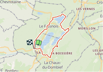
Trail Walking of 14.6 km to be discovered at Bourgogne-Franche-Comté, Jura, Le Frasnois. This trail is proposed by Bart2015.

Description

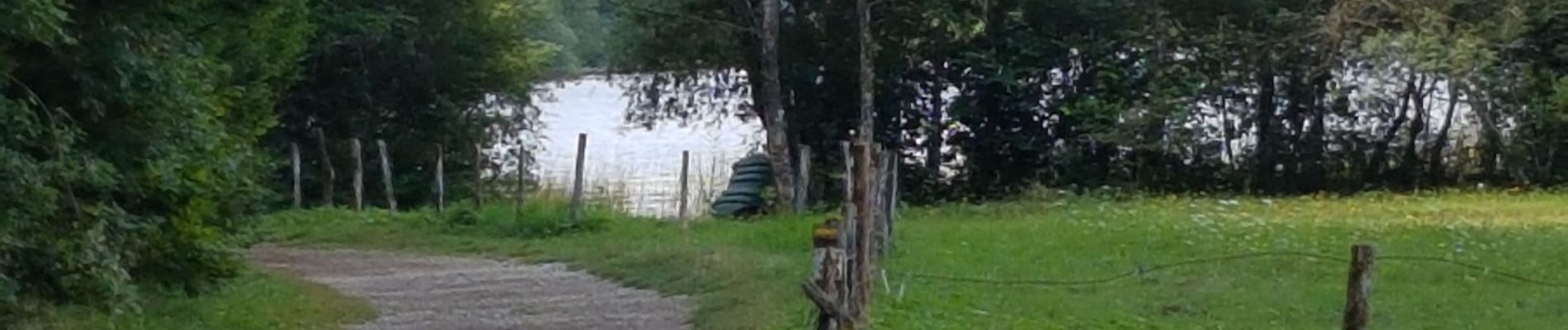
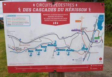
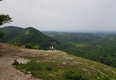
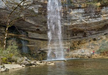
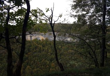
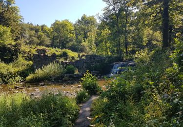
Belle rando au départ de La Fromagerie pour découvrir les 4 lacs autour de Le Franois : lac de la Motte, de Narlay et les Petit et Grand Maclu. Montée délicate après le lac de Narlay surtout après les pluies (bonnes chaussures et prudence recommandées). La vue depuis le belvédère des 4 lacs est magnifique. Sinon possibilité de longer les lacs des Petit et Grand Maclu. Descecente également délicate bien sûr ...
Bonne rando ...

Elevation profile

Photos

27 photos in total. Please click on a photo to see them all in the gallery.

Positioning

Country:
France
Region :
Bourgogne-Franche-Comté
Department/Province :
Jura
Municipality :
Le Frasnois
Location:
Unknown
Start:(UTM)
720667 ; 5166750 (31T) N.

Trails nearby

Trail Walking Le Frasnois - Cascades du Hérisson et les 4 lacs  - Photo
Walking
GUIDE
mumu.larandonneuse

Walking

Medium
(1)
Le Frasnois, Bourgogne-Franche-Comté, Jura, France
15.4 km | 20 km-effort
4h 35min
No
Trail Walking Menétrux-en-Joux - Les cascades du Hérisson : Boucle du randonneur - Photo
Walking
VacheKiri67

Walking

Medium
(3)
Menétrux-en-Joux, Bourgogne-Franche-Comté, Jura, France
14.5 km | 20 km-effort
5h 10min
Yes
Trail Walking Menétrux-en-Joux - Le Hérisson et ses cascades - Photo
Walking
tracegps

Walking

Medium
(7)
Menétrux-en-Joux, Bourgogne-Franche-Comté, Jura, France
11.9 km | 17.6 km-effort
4h 0min
Yes
Trail Walking Le Frasnois - Lac de Narlay - Pic de l'Aigle - Photo
Walking
GUIDE
mumu.larandonneuse

Walking

Medium
Le Frasnois, Bourgogne-Franche-Comté, Jura, France
16.3 km | 22 km-effort
7h 1min
Yes
Trail Walking Le Frasnois - lacs des maclut - Photo
Walking
bonj39

Walking

Very easy
(1)
Le Frasnois, Bourgogne-Franche-Comté, Jura, France
9.6 km | 12.1 km-effort
2h 1min
No
Trail Walking La Chaux-du-Dombief - pic de l''aigle - la Chaux-du-Dombief - Photo
Walking
CharlyG57

Walking

Very easy
(1)
La Chaux-du-Dombief, Bourgogne-Franche-Comté, Jura, France
6.3 km | 9.2 km-effort
Unknown
No
Trail Walking Le Frasnois - Ilay Menetrux en Joux cascades du Herisson - Photo
Walking
grasgilbert

Walking

Difficult
Le Frasnois, Bourgogne-Franche-Comté, Jura, France
12.7 km | 17.8 km-effort
4h 2min
Yes
Trail Walking Bonlieu - Cascades du Hérisson - Photo
Walking
GUIDE
David25400

Walking

Very easy
Bonlieu, Bourgogne-Franche-Comté, Jura, France
4.8 km | 7.6 km-effort
1h 56min
Yes
Trail Walking Menétrux-en-Joux - Ménétrux-en-Joux - cascades Evantail et Hérisson - Saut de la Forge - La Fromagerie - Photo
Walking
Bart2015

Walking

Very difficult
Menétrux-en-Joux, Bourgogne-Franche-Comté, Jura, France
13.6 km | 19.7 km-effort
4h 28min
Yes


Close
My subscriptions